


First tourist city map, issued on the occasion of the world exhibition in Amsterdam
Description Amsterdam Geïllustreerd. (recto); Geïllustreerd plan van Amsterdam. (verso)
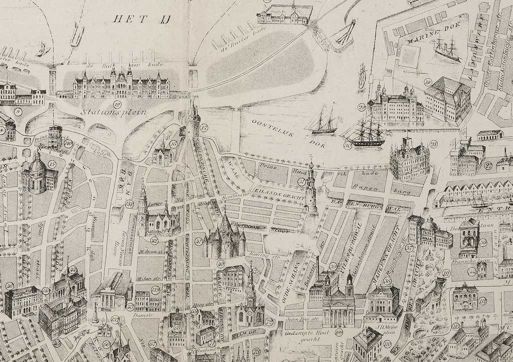
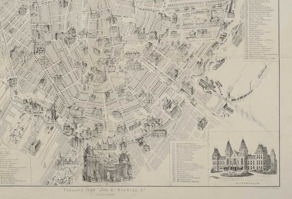
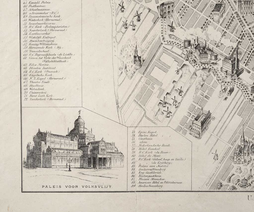
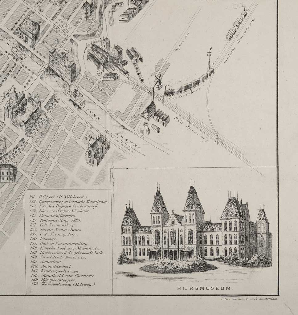
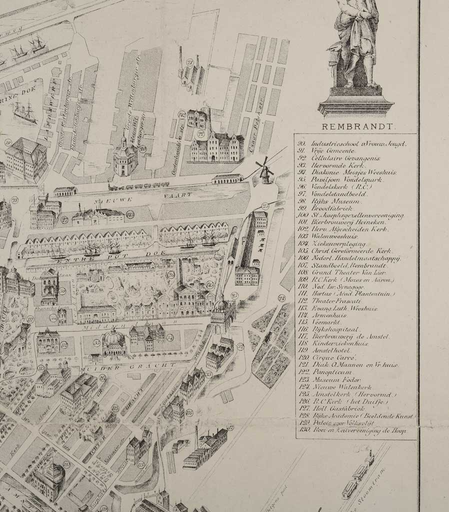
First edition of the map of Amsterdam with 150 numbered and 3-dimensional signed buildings on scale 1: 10.500, published by Joh.G. Stemler Cz. and printed by the Gebroeders Braakensiek.
Orientation: north-northeast up.
Creators Janusch, E.H.; Stemler Czn, J.G.; Gebroeders Braakensiek
Dating 1883
Dimensions 56 x 43.5 cm
Condition good
Divers very rare